
«Intelligent System for Finding the Optimal Route to Cover Multiple Locations in Astana with Time and Mobility Constraints»
Project Supervisor: Edilkhan D., PhD, Associate Professor, Director of the Smart City Research Center
Project Objective
Development of an intelligent system for finding the optimal route to cover multiple locations in the city of Astana with time and mobility constraints
Objectives
• The research objectives include the following points, in accordance with the overall goal of the study:
Literature review on the research topic.
Selection of cartographic APIs to obtain accurate and up-to-date data on roads and streets of the city of Astana.
Retrieval of street network data from cartographic APIs and transformation into a graph structure for efficient processing, including data preprocessing such as cleaning, preparation, and formatting for compatibility with the chosen algorithm.
Development of an algorithm for finding the optimal route to cover multiple locations in the city in the shortest time and with minimal movements.
Visualization and analysis of results, including the creation of maps and graphs to clearly present the algorithm’s performance.
Publication of research results.
The idea of the research project is to develop an intelligent system for finding the optimal route to cover / visit multiple locations in the city of Astana within minimal / specified time and with minimal movements. Using the developed algorithm, the system will enable significant savings in cost and time when applying the results to practical tasks, such as determining movement algorithms for snow removal vehicles, dynamic measurement of air quality indicators, irrigation planning, and many other applications.
Results
1. A comprehensive literature review and analysis on the research topic has been conducted, including both international and Kazakhstani studies — more than 50 sources were analyzed, many of which relate to the classical Travelling Salesman Problem (TSP) and its various approximations and optimizations.
2. Accurate and up-to-date data on all roads (streets) and intersections of the city of Astana have been obtained. The operating principles of various cartographic systems have been thoroughly examined, including Yandex Maps API, Open Source Routing Machine (OSRM), YOURS Navigation API, OpenRouteService Library, GraphHopper Directions API, 2GIS API, Google Maps Directions API, Bing Maps Directions API, ESRI Maps Directions API, MapQuest Directions API, and Mapbox Directions API.
2. Accurate and up-to-date data on all roads (streets) and intersections of the city of Astana have been obtained. The operating principles of various cartographic systems have been thoroughly examined, including Yandex Maps API, Open Source Routing Machine (OSRM), YOURS Navigation API, OpenRouteService Library, GraphHopper Directions API, 2GIS API, Google Maps Directions API, Bing Maps Directions API, ESRI Maps Directions API, MapQuest Directions API, and Mapbox Directions API.

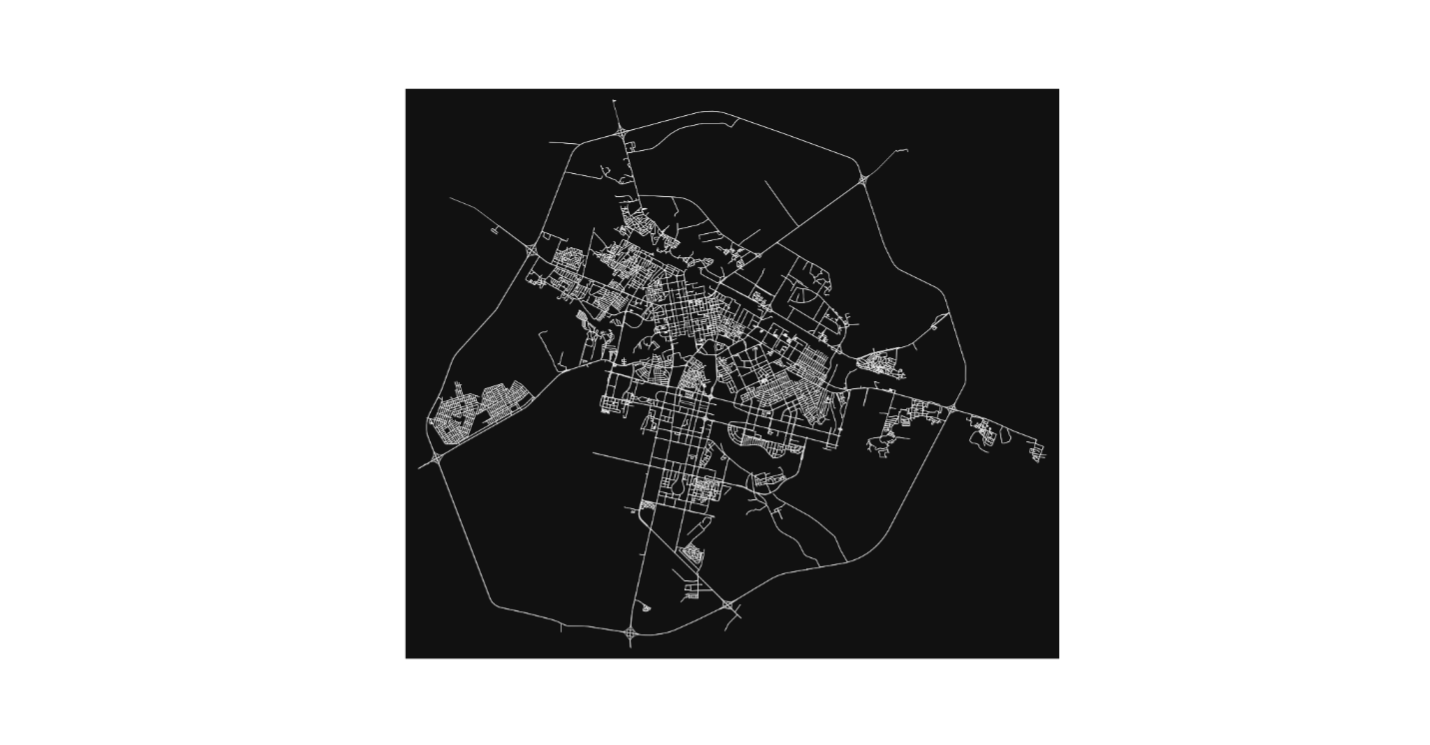
3. The data are represented in the form of graphs after cleaning and processing procedures. Below is an example of a visualized road graph (only automobile roads):
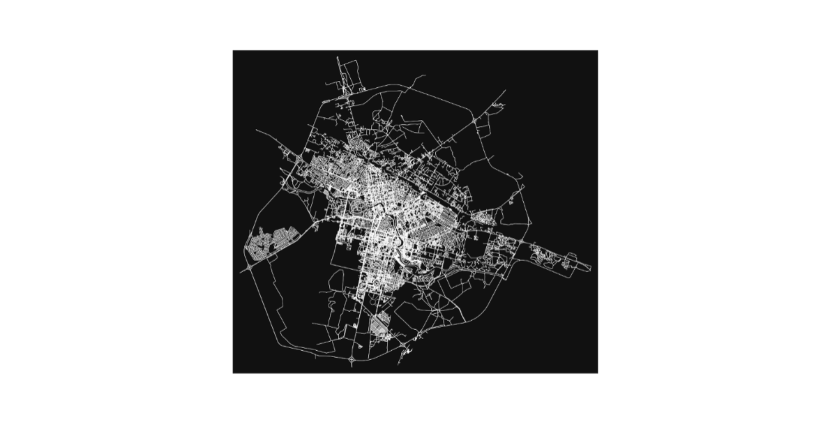
Example of a visualized road graph (all types of roads):
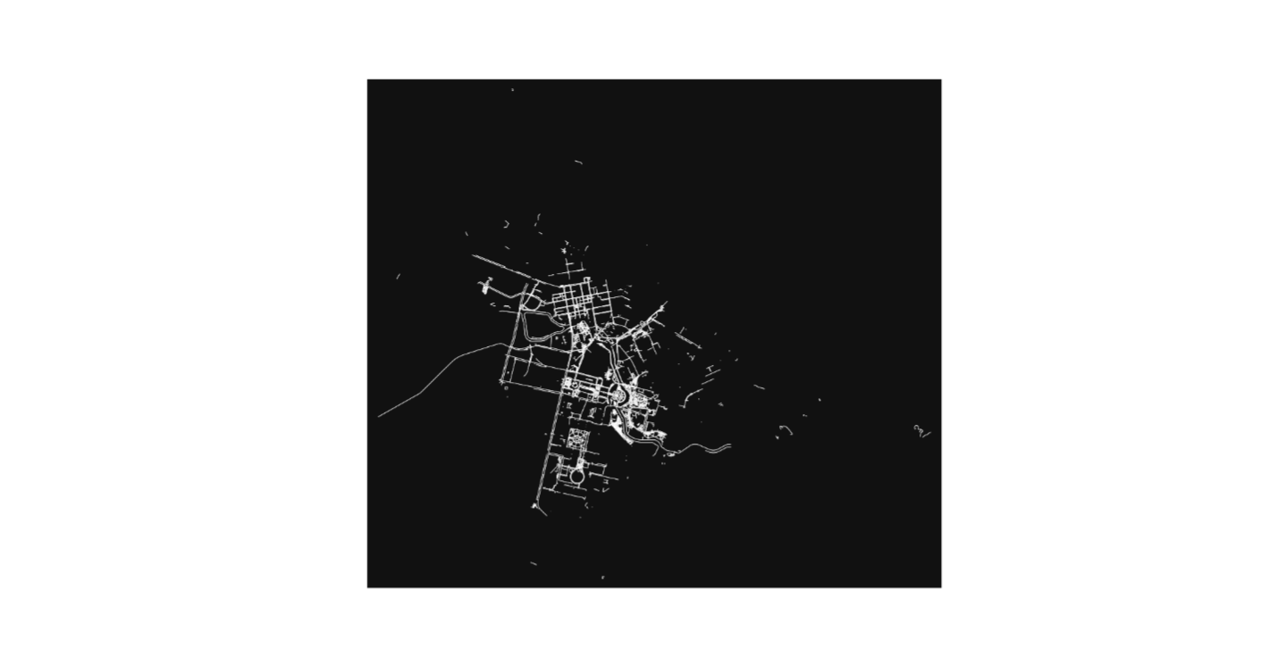
Example of a visualized pedestrian road graph after filtering (pedestrian only):
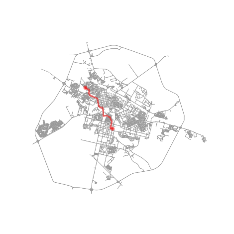
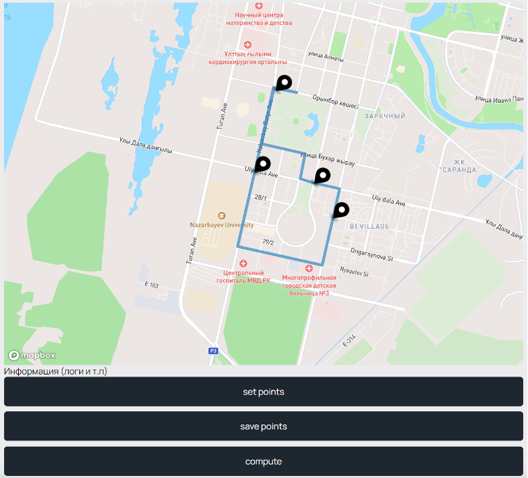
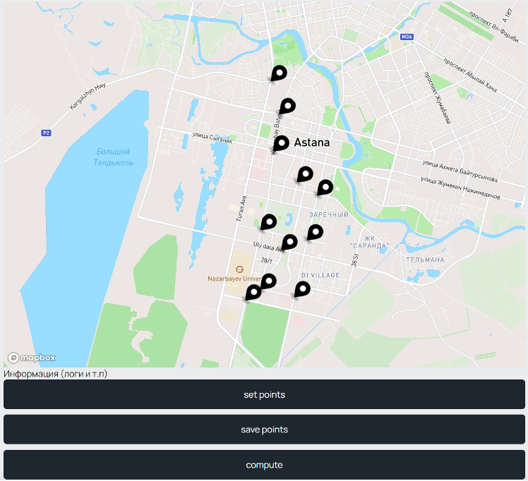
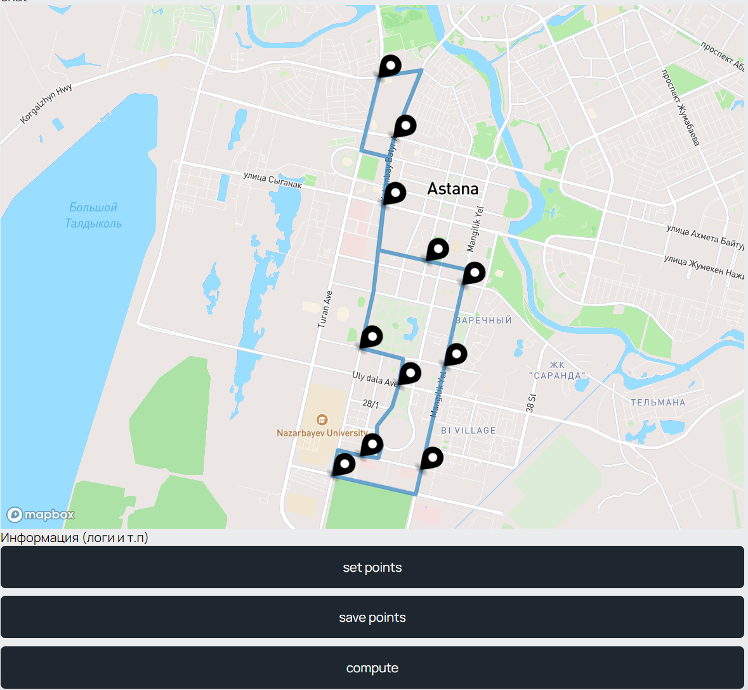
4. An algorithm for finding the optimal route to cover multiple locations in the city of Astana has been developed. Below is an example of a visualized route between two points using the algorithm:
5. A more illustrative visualization and analysis of the results obtained during the research have been carried out.
6. One (1) article is being published in peer-reviewed scientific journals relevant to the project’s field, indexed in the Science Citation Index Expanded (Web of Science) and/or having a CiteScore percentile of at least 35 in the Scopus database.
Team
1. Didar Edilkhan – Project Supervisor, PhD, Associate Professor, Director of the Smart City Research Center
2. Moldir Toleubek – Project Executor, Senior Lecturer, Department of Computing and Data Science
3. Alar Akilbekov – Project Executor, 2nd-year student, Astana IT University
4. Ayan Galiyev – Project Executor, 2nd-year student, Astana IT University
2. Moldir Toleubek – Project Executor, Senior Lecturer, Department of Computing and Data Science
3. Alar Akilbekov – Project Executor, 2nd-year student, Astana IT University
4. Ayan Galiyev – Project Executor, 2nd-year student, Astana IT University